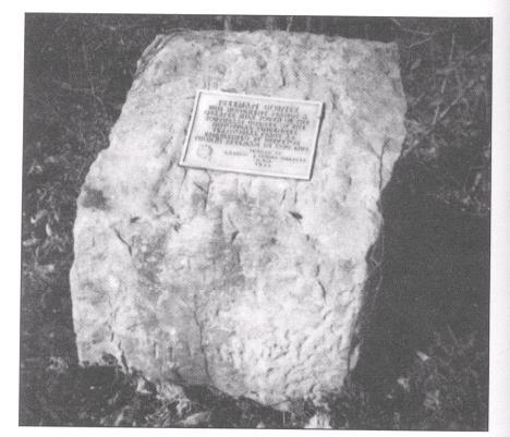
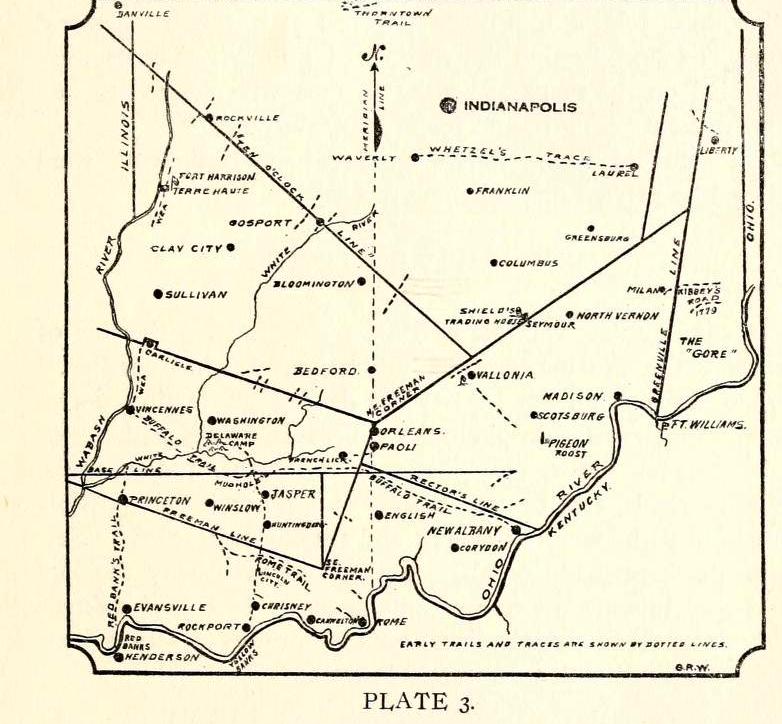
| Freeman Corner – the monument stands a quarter mile south of the South East corner of the historical Vincennes Territorial tract as established by surveyor Thomas Freeman in 1802-1803. It was placed by Lafayette Spring Chapter OAR in 1938. It stands six tenths of a mile east from St. Isidore Catholic Church. | ||
Freeman Corner The story of how there came to be a tract of land known as the Vincennes Tract with its Indian, French and English association wars, treaties and settlements and their bearing on history and surveys in Indiana constitute interesting reading dating back almost 300 years. In 1742, the Indians gave to the French at Vincennes, by means of a gift deed, a tract of land lying at right angles to the general trend of the Wabash River at Vincennes. In 1763 the English conquered it from the French, and in 1779 General George Rogers Clark captured it from the English in his conquest of the Northwest Territory. In 1803, the United States represented by William Henry Harrison, superintendent of Indian affairs and commissioner plenipotentiary of the United States, cleared the title to the land by a treaty with the Delawares, Weas, Shawnees, Putawanies, Miamias, Eel River, Kickapoos, Piankasaws, and Kaskasias nations of Indians made at Ft. Wayne. In doing this, the government bought the land from the Indians, the remote owners. |
||
| One of the articles contained in the treaty of Ft. Wayne was that the United States would furnish salt not to exceed 150 bushels from salt spring in Saline Creed to be divided among the Indians. At that time salt was a luxury and scarce. Indians were allowed to fish in rivers and cross streams on ferries free of toll during floods.The Vincennes Tract is 70 leagues long and 42 leagues wide. The general land office department of the interior describes the tract as follows: “Beginning at Point Coupee on the Wabash and running thence by a line north 78 degrees west 12 miles, thence by a line parallel to the general course of the Wabash unit it shall intersect by a line at right angles to the same, passing through the mouth of White River, thence by the last mentioned line across the Wabash and toward the Ohio 72 miles thence by a line north 12 degrees west until it shall be intersected by a line at right angles to the same passing through Point Coupee and by the last mentioned line to the place of beginning. Most of the land lies in Indiana, but a small part is in Illinois. The boundary lines of the Vincennes Tract are known as the old Indian boundary lines of the Vincennes Tract.
Mr. and Mrs. Delaisse, who owned the farm on which the corner is located, said they found all markings listed in the interior’s description. Delaisse said he has sold considerable timber from his farm, but because the witness trees of beech are not suitable for lumber, they have been forced to grow tall to reach the sunlight. Wilson, the historian-surveyor, tells an unusual story as he begins his walk in 1927 to follow Freeman’s original survey as the search for the corner began. “In an hour’s time,” he said, “the marks of the old surveys began to appear. They grew plainer and plainer as they neared the border and finally upon three moss-covered beech trees were the figures and letters wanted. They had broadened until the lines were two inches wide and eight inches long.” |

